Sunday, February 6, 2011

Cronulla and Bundeena

 Cronulla lies to the south of Botany Bay, at the end of a long, curved beach that mostly faces due east. The Pacific swells come rolling in directly to the beach, creating a surfers' heaven. The town is about 20 kms. from the centre of Sydney and not far from Sydney Airport; planes are constantly landing or taking off over the sea. Train services run into Sydney, so we can assume there is a lot of commuting, especially by people who like to get their surfing in before they go to work. When we took an early morning walk on the day we left, there were dozens of surfers at 7:00 am.
         The southern part of Cronulla looks out onto Gunamatta Bay, which is sheltered from the waves of the ocean and is stuffed with expensive boats at anchor or at the jetties of the expensive houses that line the shore. Across the bay is Bundeena, a small town at the northern end of Royal National Park, and several coastal hikes start from the beaches and cliffs of the town. If you have two days to spare, you can hike the whole length of the coastline down to Bald Hill Overlook, at the southern end of the Park, where our rental car had exploded the day before.
         
 But to get to Bundeena by car by driving around Gunamatta Bay takes about an hour, as the road has to circle far inland around the bay. Alternatively, there is a ferry service from Cronulla that runs on the half hour through the day, and we took it at 8:30 am to cross to Bundeena for a coastal hike.

 When the ferry came in from Bundeena, crowds of schoolchildren disembarked to go to school in Cronulla, and when we got to Bundeena another, larger crowd of kids, swarmed onto the boat.
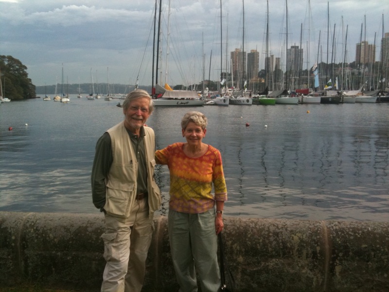
We followed the hiking trail across beaches and along the cliffs out to Point Hacking, where the bay meets the ocean, and we thought we should memorialize our last sight of the Pacific swell crashing against the coast.
Further on the trail turned inland through thick vegetation, and we began to be conscious of SPIDERS, and as everyone knows--Australia is full of poisonous spiders--the Sydney Tunnel-web, the Redback, the bird-eating (yes) Tarantulas, the Huntsman, and the Black Widow.  The spiders we encountered were BIG, and their enormous webs were strung right across our path. Sometimes the network of webs was huge, creating a sort of web-city, occupied by a large number of spiders. Difficult to photograph, but we did our best.
After the hike, we had our final swim from one of the beaches, before going back to catch the ferry. During the walk along the beach I could not resist taking some ‘abstracts’ of patterns in the rocks.

And Joan liked the mosaic of the Kookaburra at the ferry station.
On the ferry back, it seemed at one point that we would have to repel boarders, as a whole fleet of surf-board paddlers bore down on the ferry.

A meal by the sea. Back to the motel. And we packed to be ready to leave in the morning. We took off from Sydney Airport at about 1.30pm for the 12 hours 50 minutes flight to Los Angeles. And from there back to Washington, and a drop in temperature from about 100F to 40F.


Saturday, February 5, 2011

Pacific Highway


The route up the New South Wales coast that took us back to the outskirts of Sydney has some spectacular scenic stretches, but for the most part—whether on the Pacific Highway or on Princes Highway—it leads you through the main streets of a succession of similar seaside towns with long surf beaches, headlands with lighthouses, and a lot of traffic.
We were tempted off the route by Kiama, which claimed both a “Little Blowhole,” and a “Big Blowhole.” We found our way easily to the Little Blowhole, which was in an area of attractive modern houses overlooking the sea.
We also tried to find the “Big Blowhole” and the Historic Lighthouse (many of the towns claimed a historic lighthouse) but found both totally surrounded by parked cars with nowhere to edge our monster Ford Falcon into a space. Oh well—what’s one blowhole more or less.
   
We were tempted to swim in one of the rock pools that are constructed at many beaches, giving swimmers somewhere to swim, as opposed to jumping up and down in the sea as the surf rolls in. These are commonly constructed so that they fill with seawater at high tide, and often have waves crashing over the outer walls, giving the swimmers some impression that they are actually swimming in the sea.

The ugliest part of the drive was through Woolongong, which turned out to be a major industrial and coal shipping centre, with a huge steel works and a zinc smelting plant. The coal ships were waiting in line offshore from the coal wharf, ready to ship Australia’s coal off to China—in exchange for the huge inflow of consumer goods made in China.

  The old road over the high rocky promontory that leads into the southern end of Royal National Park--Lawrence Hargrave Drive--was one of the most scenic roads in Australia, but was notorious for rock falls. In August 2003, a large embankment slip called for a complete road closure. The road remained closed for two and a half years to avoid further rock falls and to allow for the construction of the Sea Cliff Bridge, which was opened in December 2005. To quote the guidebook--
“The 665 metre Sea Cliff Bridge is a highlight along Grand Pacific Drive. The bridge has become an icon to the people of Wollongong and around the world, welcoming tourists’ to this picturesque coastal road.” Of course, the people of Woolongong also have to look at the chimneys of the steel works. 
Out of context--but a good picture, isn't it?
After the sea bridge, we wound up a hill to reach Bald Hill Overlook, high above the ocean, and pulled in to park and look at the view. Moments later, with a huge roar and hiss of escaping steam, a pipe in the heating and cooling system in the car burst open, spewing green coolant onto the ground and scaring the whatever out of us.
   We called the roadside service that the rental car agency subscribed to, and within an hour and a half the NMRA (we suppose the equivalent of AAA or RAC) had arrived and very efficiently replaced the failed hose, filled the cooling system, checked the pressure in the system, topped up our engine oil, run the engine, run the air-conditioning—and pronounced us good to go. Thank you, Tony.
 Before we made our distress call, a young couple came and asked what our problem was, and the young man spotted the hose failure. They said they were going into town and would be back in an hour or so, and that they would check with us to see if the problem had been solved. And they did—rolling in again just as Tony was calling the rental car agency to tell them what the failure had been. This was a good example of the helpfulness we often encountered along the way.
We drove on through Royal National Park, established in 1879—the second national park in the world after Yellowstone—and eventually came back to the highway and thick, thick traffic, through which we drove, somewhat on edge, into the town of Cronulla. We had somehow, erroneously, expected it to be a rather small seaside place. Wrong—it is on the border of the greater Sydney conurbation and has a superb surfing beach that stretches from the town centre for as far as the eye can see—and as far as the eye could see there were surfers. There was not a spare parking place anywhere, and we began to despair of finding somewhere to stay. 


 But luckily we got the last room in a motel close to the town centre; we had a swim in their  pool; enjoyed a beer; the crowds eased on the beaches: and we had an excellent meal at Salt, a restaurant with a large picture window through which we could watch the surfers and the surf rescue team as we ate. Some were still at it as darkness fell.  


Booderee National Park


Not far from Paperbark Camp, on the shores of Jervis Bay, is a National Park called Booderee Park, which we visited.  'Booderee' is an Aboriginal word from the Dhurga language meaning 'bay of plenty' or 'plenty of fish'. The park is owned by the Wreck Bay Aboriginal Community and has always been a significant place for Koori people. Incidentally, the total aboriginal population of Australia is about 550,000—or 2.7 percent of the population. There are hundreds of different aboriginal languages, reflecting the small groupings of people spread out over a huge continent.
 The description in the Park Guide is very accurate:
“The crystal clear waters and rich variety of habitats in Booderee National Park and Botanic Gardens offer visitors a wide range of things to explore. With over 200 species of birds, 30 species of land mammals and 180 species of fish - Booderee National Park is a fantastic place to meet Australian fauna.”
One of the fauna is the endangered Bristlebird: 
 What motorists are supposed to do about them is unclear--perhaps like British wagtails they strut around in the road.


And one of the flora in the Botanic Gardens (where we were the only visitors) was this orchid:


The ‘crystal clear waters’ are at their best in Murray’s Bay, where for once the surf does not crash into the shore. The water is turquoise in colour, there is a fringe of palm and other trees, and very few people are on the soft, sandy beach. The headland shields the beach from the Pacific swell, making it an ideal swimming spot.
   

There is also a hiking trail—Murray’s Walk—that takes you on a loop up onto the high cliffs overlooking the ocean.
   
Wreck Bay Village itself now has an aboriginal population of about 200, living in neat little brick bungalows--obviously government built. The history of the community is probably typical: there was a much larger flourishing community in the 19th century, decimated by “disease, guns, and imprisonment.”
   
   The road to Booderee runs through Huskisson, which students of British history will immediately realize was named after the British Cabinet Minister whose claim to fame is that he was the first fatal casualty of a train accident. He was killed in 1830 by Stephenson’s ‘Rocket’ at the opening of the Liverpool and Manchester Railway. Huskisson lies at the mouth of the creek that flows by Paperbark Camp.
   Near Booderee, in the town of Vincentia, was a roadside bus shelter, irresistible to the digital photographer, with some of the best bus shelter murals we had seen. You wonder who does them, who plans them, how long did it take take them to do something so intricate.


Friday, February 4, 2011

Paperbark Camp

The ultimate indulgence of my (Joan’s) prediliction for the offbeat came with our stay at Paperbark Camp near Jervis Bay, which describes itself as part of the trend in “nature based tourism and ecologically sustainable development.”  I just thought it sounded neat to sleep in a tent, having not done so since Girl Scout camp in the Ozarks (also--like Australia--home to several venomous snakes).
The accommodation essentially consists of a platform on stilts on which rests a large tent with mesh windows and a canvas roof.

The "bathroom" was behind the tent on the platform, more or less in open air, and included a flush toilet and a surprisingly hot shower. We hoped we were sheltered from our neighbors’ view when we used the bathroom. There are 12 tents, given names like “Wombat,” “Bandicoot,” and “Penquin.”  A solar panel charges a battery that provides the bathroom and bedside lights inside.


Guests dine in an architecturally interesting structure containing the Gunyah restaurant (it is an Aboriginal word meaning “meeting place”, the same origin as the name Canberra), offering candle-lit dinners under the gum trees by the verandah. The cuisine is excellent--featuring such dishes as fresh oysters (delicious) and kangaroo meat steaks (we declined: it would be like eating Bambi).


Upon checking in and being shown to our tent, we were instructed to keep the zippers closed at night with a carabiner, to keep out the brush-tailed possums that inhabit the surrounding bush.  Above all, we were told NOT to leave ANYTHING remotely edible in your tent at night, or you’ll be overrun with possums, which can smell food from far away.  They have even been known to swipe shampoo and cosmetics left out in the “bathroom.” 
We sat on our front deck, swatting away the “mozzies” that became fierce at dusk. At that time, we thought that, as promised, the bush would come alive with wild creatures.  With anticipation, we turned out the light, but saw no wildlife with the flashlight provided to all guests. We turned out the light to go to sleep, the drone of cicadas in the air—a taste of  primordial “life in the bush.”
At dawn, we were awakened by a cacophony of bird noises.  And I mean a real cacophony, not the melodies of little songbirds (not the famously sweet British morning chorus). David told me he lay awake for half an hour thinking of all the words that might describe what we heard—screeching, wailing, bleating, cheeping, laughing, mocking, squawking, hooting, whooping—ad nauseam. So much for turning over and having another hour’s snooze.

The main activity right at the resort, besides swatting mosquitoes, is canoeing on the adjacent Currambene Creek, which flows down to the town of Huskisson (self-proclaimed as “Australia’s first coastal plastic bag-free town”, but more importantly containing a drive-through beer store).  We had an early morning paddle, in which the creek-side trees and bush were perfectly reflected on the water.

The Camp was an unusual place, certainly a far cry from the Adelphi Hotel, Melbourne. And it had no television—an ecological no no, perhaps?--so we could not watch the final of the Australian Open, being played only a few hundred miles away, which the rest of the world was able to view.


Paperbark Tree
Footnote:  This blog was composed as I knelt to use the computer, which was placed on a trunk in our "tent".  David captured the moment in this photo, in which I am perfectly framed by his feet.

Saturday, January 29, 2011

Galah Bird

The Galah bird is related to the cockatoos and will breed with them. They are very difficult to photograph. They seem to sense the moment when you are about to click the shutter, and the whole flock rises up screeching. Joan has assiduously stalked them, camera in hand, but could not get close enough for a decent photo. She used the super-zoom, but that blurs the picture and reduces the light. So we went to Wikipedia and cut and pasted a couple of pictures.
Galahs, male and female.Galahs, male and female.
Photo: R Major © Australian Museum
Galahs. Image from: John Gould (1804-81) The birds of Australia 1840-48. 7 vols. 600 plates Artists: J. Gould and E. Gould; Lithographer: E. Gould.Galahs. Image from: John Gould (1804-81) The birds of Australia 1840-48. 


Eden Evening

Early in the evening Joan was stalking the birds that come and  eat their supper on the lawns of the place we are staying. They are called Galahs--see next post. They seem to be some species of parrot, and when disturbed they create a great deal of noise—just like the cockatoos, which screech around all day.

We had been recommended to eat at the Fishermen’s Club—where I got the beer last night after driving the wrong way down a one-way street.
I had not realized how much entertainment the Club provided. Slot machines (“pokies”) each of which had an admonishment to gamblers to think of your family and provided a web-site for addicts to help break the gambling habit.

But if you did not fancy the pokies, you could go into the TAB section, where banks of computer screens allowed you to bet on racing, harness racing, dog racing, and I expect a lot more. It was the first time I have ever seen greyhound racing on television.


In the restaurant, they had a very efficient system that could be universally adopted. Read the menu. Go to the counter. Order. You get a beeper, and when it goes off, you collect the food. Order wine or beer from the bar. We got an excellent white wine for $12.
We left the Club and wandered down the main street, seeking ice creams. We were surprised to see two major hotels.


And here and there were historic markers.
After creating a crisis in the ice cream parlour as they had run out of cones, we drove to one of Eden’s beaches (the “Family Swim” beach) and perambulated from one end to the other as the sun went down.  I am attracted by the patterns on the rocks, and created two abstract pictures--close ups of rocks:

Joan paddled barefoot through the incoming waves into the sunset.